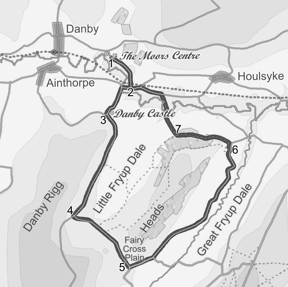
The Moors Centre at Danby is one of two official visitor centres run by the National Park Authority and is well worth a visit (the other is at Sutton Bank). This walk starts from the car park at the Moors Centre and explores the two Fryup Dales. It crosses Duck Bridge, one of several impressive old bridges across the River Esk, passes the ruins of Danby Castle, and goes through the Fairy Cross Plain between the two dales. Fryup is an Old English name, meaning Friga's Valley. This walk sticks to the roads for most of its length, finishing with a short walk through the woods.
Ascent: 700 feet/ 220 metres
Length: 7 miles/ 11 km
Map: OS Explorer Map OL 27
Last Walked: 30 August 2006
The Moors Centre is east of Danby, and can be reached from the A171 (the turn is just over one mile west of Scaling Reservoir). If approaching from this direction, take the first left turn in Danby to find the Moors Centre (it is well signposted).
The curve in the road means that you get good views of Danby castle from almost every angle. The castle is in private hands so please don't disturb the privacy of the owners.
Once you have passed the castle, follow the road as it curves right into Little Fryup Dale.
Just before the end of the dale, turn left and follow the road towards the gap that leads into Great Fryup Dale. Part of this gap is know as Fairy Cross Plain (the name is now marked on a field close to the road, although on older maps it is clearly linked to the farm house that sits in the gap).
Our road runs along the western side of Great Fryup Dale. At first it stays high up the side of the valley, giving great views back towards the high moors and north towards the Esk Valley. About half way along the dale, the road moves down to the valley bottom, and gently meanders amongst the fields.
Our map shows a more interesting route back, through the woods at the foot of Danby Crag. Part of this path can get very wet, so don't use this route unless you are wearing suitable boots. Just before the road through Great Fryup Dale turns sharply to the right, a small farm lanes leads off the to the left. A gate leads into the field north of this farm lane.
Pass though this gate. In the field a faint track follows the level ground to the right of the trees (see picture). Follow this track. As you follow it, it will become increasingly clear. Just around the corner, our track crosses another much clearer one that joins from the left. Ignore this track as it heads off down the hill, and keep to our grassy track as it heads into the trees. Just inside the trees, turn right onto what can be a wet path, running level along the edge of the hill and follow this track through the woods.
Our road runs parallel to the railway line. About a third of a mile after joining the road, follow it as it swings right under the railway (ignore the first bridge under the railway on a small lane). From here return to the car park using the same road we started on.