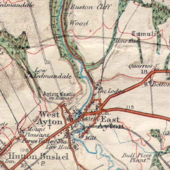
Here we see the villages of West Ayton and East Ayton as they were in 1914. Unlike many villages within the National Park these two villages expanded significantly during the twentieth century.
West Ayton has expanded the least, with new developments south of the old railway that have rougly doubled the size of the village since 1914.
East Ayton has tripled in size, with large develpments to the north-east of the old village, most of them to the north of the road to Scarborough.
In both cases the new houses have been built outside the boundaries of the National Park, which runs through both villages. In West Ayton the boundary follows the line of the railway, while in East Ayton it runs up the minor road that runs from the mill close to the railway to the church, and then north up the minor road that runs under the T of 'The Lodge' on this map.