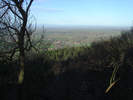
Ingleby Greenhow is an attractive village at the entrance to Greenhow Bottom, a dramatic valley that cuts into the northern edge of the North York Moors. The village is bordered by the steep escarpment at the edge of the moors to the east and south, with Round Hill, the highest point on the Moors, due south of the village. The eastern escarpment continues on north toward Captain Cook's Monument and beyond that Roseberry Topping, while the southern escapement runs across a series of dramatic hills on the way to Carleton Moor. Ingleby Greenhow is thus in the centre of one of the most impressive views from the North York Moors.
 The village is built around two parallel streets. To the south is Marsh Lane, which heads east out of the village across areas that used to be swamp. The village church is at the eastern end of Marsh Lane. The short Church Lane runs north to the second main street, which has two names. West is Ingleby Avenue, which runs west before curving north to head out of the village towards Easby. East is Stone Stoup Hill which heads out towards Battersby.
Half way between Ingleby Greenhow and Battersby is Battersby Junction, still the site of a railway station. A single line runs into the station, splitting just to the north, with one branch heading to Middlesborough and the other running east to Kildale and beyond that to Esk Dale and Whitby (and the link to the North York Moors Railway). Two more lines used to meet at the junction. The North Yorkshire and Cleveland ran west past Stokesley to join the main railway to Stockton. The fourth line was the industrial line that ran south to Ingleby Incline, a long incline that brought ore down from the Rosedale Railway to the lowland rail network. The rails are long-gone, but the incline is an unusual (but surprisingly steep) footpath.
Avenues of trees were planted around the village to commemorate deliverance from the two world wars.
Ingleby comes from the Danish for 'farmstead or village of the English', while Greenhow comes from the 12th century 'Grenehou' or green mound, probably referring to the dramatic hills to the south.
The Norman Church of St Andrew is at the southern end of the village. The oldest parts of the church date back to the 12the century. It was restored in 1741 and 1906 but many older features still survive.
Ingleby Manor is located just under half a mile to the south-east of the village. The manor is reached along a drive that leaves the village close to the church and runs through trees on the east bank of Ingleby Beck.
The house was built in the sixteenth century and is a rectangular building built around two courtyards. The main entrance is on the northern end of the northern courtyard and is topped by a short tower. The main house now contains four self-catered apartments that can be rented as holiday cottages (http://www.inglebymanor.co.uk/index.html).
The manor house was built by the Eure family, but only owned by them for about a century. In 1608 Ralph, Third Lord Eure, had to sell the estate to clear his debts. The house was brought by Sir David Foulis, a Scottish courtier who had come to England with James I/ VI. The manor remained in the Foulis family until the mid 1800s when it was inherited by Lady Mary Foulis. She married the 2nd Lord de Lisle, and it remained in their family until 1950.
The religious author Henry Foulis (d.1669), the author of tracts against the Presbyterians (History of the wicked Plots and Conspiracies of our pretended Saints the Presbyterians) and Catholics (The History of the Romish Treasons and Usurpations), was baptised at Ingleby Greenhow in 1635, and was the second son of Sir Henry Foulis, second baronet, then the owner of Ingleby Manor.
Grid Reference: NZ 581 063