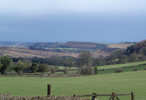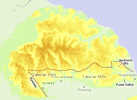

The Tabular Hills is the name given to the hills on the southern boundary of the North York Moors, and refers to their  flat tabular summits, seperated by steep sided valleys. The most distinctive feature of the Tabular Hills is their northern escarpment, which rises up to 200ft above the nearby moorland to the north, and runs from Scarborough in the east all the way to Black Hambleton, on the western edge of the moors, via Saltergate and Hutton-le-Hole. The western part of this escarpment, beyond the River Rye, is known as the Hambleton Hills).
 The Tabular Hills are made up of limestone and calcareous sandstone, which erodes much more slowly than the Oxford Clays which had covered the area to the north. Even so, the northern escarpment of the hills is still eroding, leaving behind isolated areas such as Hawnby Hill or Blakey Topping, where caps of harder limestone have survived the erosion.
Most of the rivers that cut through the Tabular Hills, giving them their distinctive appearance, rise on the high moors further north. The main exceptions are the streams in the Hackness Hills, at the east of the area, which all rise in the Tabular Hills, and two dramatic glacial valleys - Newton Dale and Forge Valley. These last two valleys were formed when rivers that normally drained east into the sea - the Esk and the Derwent respectively - were blocked by glaciers to the east. Large lakes formed, and eventually burst over the hills to the south, cutting these dramatic new valleys over a short period of time - perhaps as little as a few decades for Newton Dale. While the Esk eventually returned to its normal course, the Derwent now flows west to join the Ouse, and eventually the Humber.
The gentle southern slopes of the Tabular Hills are mostly agricultural, although Levisham Moor remains covered in heather and some of the eastern hills are now covered in forests. The northern slopes are all either forested or covered in shrub. The Tabular Hills are never very high, reaching a height of 1,000ft above Helmsley Bank, while the highest point on the Hackness Hills is only 714ft above sea level.
 The escarpment can be seen to good effect from Saltergate and on Levisham Moor, from the Roman practise works at Cawthrone, from the top of Cropton Bank, from Blakey Road north of Hutton-le-Hole, from the car park at the top of Cowhouse Bank (past the village of Carlton on the road north from Helmsley), or from the top of Hawnby Hill. The best walk along the escarpment starts at the car park at Newgate Bank on the B 1257, and heads around the edge of Rievaulx Moor and Helmsley Moor, reaching a high point of 328m above Helmsley Bank.
Most of the villages in the southern part of the moors are to be found either on the Tabular Hills (Cropton, Spaunton, Gillamoor) or at the foot of their northern escarpment (Lastingham, Hutton-le-Hole), while the main market towns of the area line the southern edge of the hills, where the hills disappear into the Vale of Pickering.
Walks in the Tabular Hills
SE 8685/01: Kirkdale and Gillamoor
SE 8382/01 Thornton-le-Dale and Dalby Forest
SE 7485 /01 Sinnington and the River Seven
SE 5689/01 Rievaulx and Helmsley Moors