Westerdale is an enclosed valley that sits at the head of Esk Dale, with some of the highest land in the North York Moors surrounding the head of the dale.
 For most of its course the Esk runs from west to east through Esk Dale, with a series of smaller valleys running into it from the south. At the western end of the valley this pattern changes slightly. Three valleys come together just to the west of Castleton. The main road comes in from the north-west, in the valley that contains Commondale. A little further to the west Baysdale and Westerdale merge, with Baysdale running west-west and
 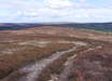 Westerdale coming in from the south. The entrance of Westerdale is guarded by high ground, with one of two Westerdale Moors on the west and a spur of Castleton Rigg on the east. Once you are past this narrow entrance the valley widens and splits, with one branch carrying Tower Beck and the larger branch still carrying the River Esk. Westerdale village sits at the northern end of the low ridge between these two branches, overlooking the Esk.
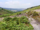
 As we follow the Esk south the valley gets narrower and wilder, until we reach the charmingly titled Esklets, where the river rises below Esklets Crag. This part of the valley belongs to the walker, who can follow the valley path onto the ridge between Westerdale and Farndale, joining the Rosedale Railway.
 The surrounding hills have their fair share of historical monuments, including Ralph Cross near Rosedale Head, where the southern Westerdale Moor meets Danby High Moor. To the south we find Flat Howe and South Flat Howe, separated by a series of disused workings.
On the ridge between Baysdale and Westerdale there are a series of earthworks that probably marked the boundaries of a lost medieval village.
Iron ore was found here and the valley had a small scale iron industry from the 12th to 16th centuries.
 The village once contained a preceptory of the Knights Templar. The current church is nineteenth century, although with some earlier fragments.
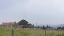
The village also contains Westerdale Lodge. This was built as a Victorian hunting lodge, later became a Youth Hostle, and then a private house.
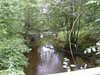
 To the north-west of the village is Hunter's Stee, a medieval packhorse bridge with a ribbed under structure, crossing the Esk.
Four roads lead into Westerdale. If coming from the south, look for the left-hand turn just north of Rosedale Head on the road that runs up Blakey Rigg and Castleton Rigg - this runs along a ridge of Westerdale Moor and drops down into the village from the south. Half way along Castleton Rigg a second road branches off to the left, dropping half way down the side of the ridge before continuing north. About a mile further north turn left onto a minor road than runs due west into the village. A fair maze of roads surround Castleton - to reach Westerdale head in the same direction as the main village street (ignoring the turn onto Castleton Rigg), and follow this minor road as it runs around the northern tip of the Rigg and down into the Westerdale. Finally, if coming into Esk Dale from the Kildale direction, look for a right turn just over a mile east of the village. This crosses the railway, then crosses two moorland spurs, dropping down into Baysdale between the two. The road crosses Baysdale at Hob Hole, a lovely pausing place with useful parking.
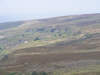
 The valley is surrounded by some of the higher ground in the area. Starting from the entrance to the valley and going counter-clockwise, we start with the first Westerdale Moor, a spur of land between Baysdale and Westerdale. The land then rises and spreads out to form Baysdale Moor, and Stockdale Moor, leading up to Stony Ridge, one of the highest points in the Moors (third behind Round Hill on Urra Moor and Crinkle Moor). The high ground then runs east/ south-east, forming the boundary between Westerdale and Farndale, running over Hwodale Hill, then up onto Farndale Moor. We then turn north, passing over Rosedale Head. Finally we reach Castleton Rigg, a lovely narrow spur between Westerdale and Danby Dale, which ends back at the narrow entrance to the valley.
Grid Reference: NY678027 to NZ674073
NZ 6807/01 Westerdale and the Esk runs the full length of the valley, and then returns along Castleton Rigg.