The Ordnance Survey maps of the Yorkshire Moors produced in 1914 are a minor work of art. We will be posting extracts from these maps for everywhere that we feature in our gazetteer of the moors. Here we will list every map as we add them.
Towns and Villages
Appleton-le-Moors
Boltby
Carlton
Cold Kirby
Cowesby
Egton
Egton Bridge
Fadmoor
Fangdale Beck
Felixkirk
Gillamoor
Goathland
Guisborough
Helmsley
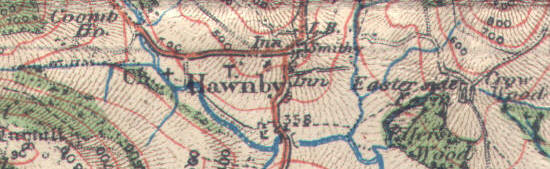
Hawnby
Hutton-le-Hole
Kirby Knowle
Kirkbymoorside
Lastingham
Levisham
Lockton
Nether Silton
Old Byland
Osmotherley
Over Silton
Pickering
Pockley
Rievaulx
Robin Hood's Bay
Rosedale Abbey
Thimbleby
Thirlby
Thornton-le-Dale
Whitby
Ancient Monuments
Brown Rigg Howe
Danby Beacon
Flat Howe (Glaisdale High Moor)
Loose Howe (Rosedale)
Nean Howe
Rawland Howe